Cujubim
Municipality in North, Brazil

Flag

Coat of arms
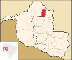
Location in Rondônia state
(2020 [1])
Cujubim is a municipality located in the Brazilian state of Rondônia. Its population was 26,183 (2020) and its area is 3,864 km².[2]
The municipality contains 22% of the Angelim Extractive Reserve and 21% of the Ipê Extractive Reserve.[3][4] It contains the 660 hectares (1,600 acres) Tucano Sustainable Yield State Forest, created in 1996.[5]
References
- v
- t
- e

Capital: Porto Velho
| Ariquemes | |
|---|---|
| Jaru | |
| Porto Velho |

| Cacoal | |
|---|---|
| Ji-Paraná | |
| Vilhena |
 | This Rondônia, Brazil location article is a stub. You can help Wikipedia by expanding it. |
- v
- t
- e


