Crane Park
Public park next to the River Crane in Twickenham, England
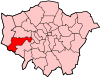
Crane Park is a 30 hectare public park next to the River Crane in western Twickenham. The park north of the river is in the London Borough of Richmond upon Thames, and the south in the London Borough of Hounslow.[1] It is part of The Crane Corridor Site of Metropolitan Importance for Nature Conservation, and includes two Local Nature Reserves, Crane Park Island and Pevensey Road.[2][3][4]

History

The Hounslow Gunpowder Works opened in the late 1760s in what is now the western end of the park. Crane Park Island was created to provide a mill pond for the water to drive the machinery. There were many explosions and the Shot Tower (pictured right) is now thought to have been a windmill for recirculating water to power the mills, rather than a shot tower for making lead shot.
The licence to manufacture gunpowder was withdrawn in 1927, and part of the site was sold to Twickenham Council, which turned it into Crane Park. This opened in 1935, and was inherited by Richmond Council when Twickenham Council was abolished in 1965.[1] The Shot Tower (now officially the Brick Tower) is a Grade II listed building.[5]
Wildlife
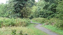
The park has large areas of woodland, as well as pasture areas and the river bank, and it also has important industrial archaeology.[1] It is managed to encourage wildlife, and Marsh frogs and the scarce water vole breed on the banks of the river.[2]
Access
Although the park borders the London Borough of Hounslow, it is only accessible from Twickenham. There are entrances on Crane Park Road, Ellerman Avenue, Hanworth Road, Mill Road, Great Chertsey Road, Hospital Bridge Road and Meadway. The London Loop long-distance footpath goes through the park.[1]
Wikimedia Commons has media related to Crane Park.
References
- ^ a b c d "Crane Park". London Parks and Gardens Trust. Archived from the original on 7 April 2017. Retrieved 6 April 2017.
- ^ a b "Crane Valley Park". London Borough of Hounslow. Archived from the original on 11 July 2013. Retrieved 24 August 2013.
- ^ "The Crane Corridor". Greenspace Information for Greater London. 2013. Archived from the original on 22 October 2013. Retrieved 24 August 2013.[dead link]
- ^ "iGiGL data portal (map)". Greenspace Information for Greater London. 2013. Archived from the original on 14 January 2014. Retrieved 24 August 2013.
- ^ Historic England (25 June 1983). "BRICK TOWER, CRANE PARK (1286731)". National Heritage List for England. Retrieved 25 August 2013.
51°26′36″N 0°22′31″W / 51.4432°N 0.37534°W / 51.4432; -0.37534
- v
- t
- e
- Bedfont (historically East Bedfont)
- Bedford Park (also partly in the London Borough of Ealing)
- Brentford
- Brentford End
- Chiswick
- Cranford
- Feltham
- Lower Feltham
- North Feltham
- Grove Park
- Gunnersbury
- Hanworth
- Hatton
- Heston
- Hounslow
- Hounslow West
- Isleworth
- Lampton
- North Hyde
- Osterley
- Spring Grove
- Woodlands

- Brentford and Isleworth
- Feltham and Heston

- All Saints, Hanworth
- All Saints, Isleworth
- Cathedral of the Nativity of the Most Holy Mother of God and the Holy Royal Martyrs
- Christ Church, Feltham
- Christ Church, Turnham Green
- Our Lady & St Christopher, Cranford
- Our Lady of Grace & St Edward, Chiswick
- Our Lady of Sorrows & St Bridget, Isleworth
- Our Lady Queen of Apostles, Heston
- Good Shepherd, Hounslow
- Holy Trinity, Hounslow
- St Dunstan, Cranford
- St Dunstan, Feltham
- St Faith, Brentford
- St Francis of Assisi, Isleworth
- St George, Hanworth
- St John the Baptist, Isleworth
- St John the Evangelist, Brentford
- St Joseph, Grove Park
- St Lawrence, Feltham
- St Leonard, Heston
- St Mary, Bedfont
- St Mary, Osterley
- St Michael, Grove Park
- St Michael and All Angels, Bedford Park
- St Michael and St Martin, Hounslow
- St Nicholas, Chiswick
- St Paul, Brentford
- St Paul, Grove Park
- St Paul, Hounslow
- St Vincent de Paul, Osterley
 Category
 Commons


