Chishtian Tehsil
Tehsil in Punjab, Pakistan
Chistian Tehsil تحصیل چشتیاں | |
|---|---|
Tehsil | |
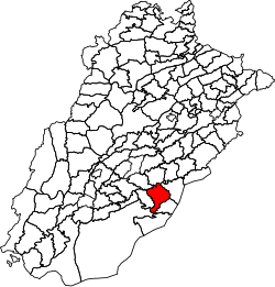 Location of Chishtian Tehsil in Punjab, Pakistan | |
| Country |  Pakistan Pakistan |
| Region |  Punjab Punjab |
| District | Bahawalnagar |
| Towns | 1 |
| Union councils | 29 |
| Headquarters | Chishtian |
| Government | |
| • Type | Tehsil Municipal Administration |
| • Administrator | Arshad Sidhu |
| Area | |
| • Tehsil | 1,500 km2 (600 sq mi) |
| Population (2017)[2] | |
| • Tehsil | 691,221 |
| • Density | 460.814/km2 (1,193.50/sq mi) |
| • Urban | 149,939 |
| • Rural | 541,282 |
| Time zone | UTC+5 (PST) |
| Area code | 063 |
Chistian Tehsil (Urdu: تحصیل چشتیاں) is a tehsil located in Bahawalnagar District, Punjab, Pakistan. The city of Chishtian is the headquarters of the tehsil which is administratively subdivided into 29 Union Councils.[3]
Geography
Chishtian Tehsil has an area of 1,500 km2.[4]
Adjacent tehsils
- Burewala Tehsil, Vehari District (north)
- Bahawalnagar Tehsil (northeast)
- Haroonabad Tehsil (southeast)
- Yazman Tehsil, Bahawalpur District (south)
- Hasilpur Tehsil, Bahawalpur District (west)
- Vehari Tehsil, Vehari District (northwest)
Demographics
| Year | Pop. | ±% p.a. |
|---|---|---|
| 1951 | 148,868 | — |
| 1961 | 197,437 | +2.86% |
| 1972 | 254,448 | +2.33% |
| 1981 | 326,790 | +2.82% |
| 1998 | 498,270 | +2.51% |
| 2017 | 691,221 | +1.74% |
| Source: [5][4] | ||
According to the 2017 Census of Pakistan there were 691,221 people living in Chishtian Tehsil and its population in 1998 was 498,270.[6]
Governance
In June 2016, Tehsil Municipal Administration Chishtian employees staged a sit-in due to two months of non-payment.[1]
References
- ^ a b "Sit-in as TMA staff unpaid for 2 months". The Nation. Lahore, Pakistan: Nawa-i-Waqt. 2016-06-30. Retrieved 2018-05-06.
- ^ "DISTRICT AND TEHSIL LEVEL POPULATION SUMMARY WITH REGION BREAKUP: PUNJAB" (PDF). Pakistan Bureau of Statistics. 2018-01-03. Archived from the original (PDF) on 2018-04-25. Retrieved 2018-04-24.
- ^ Tehsils & Unions in the District of Bahawalnagar - Government of Pakistan Archived 2012-02-09 at the Wayback Machine
- ^ a b "PLANNING REPORT BAHAWALNAGAR 2008" (PDF). Punjab Municipal Development Fund Company: Punjab Municipal Services Improvement Project (PMSIP). 2008. Retrieved 2018-05-02.
- ^ "AREA & POPULATION OF ADMINISTRATIVE UNITS BY RURAL/URBAN: 1951-1998 CENSUSES" (PDF). Pakistan Bureau of Statistics. Retrieved 2018-05-13.
- ^ "PROVINCE WISE PROVISIONAL RESULTS OF CENSUS - 2017" (PDF). Pakistan Bureau of Statistics. 2017. Archived from the original (PDF) on 2017-11-07. Retrieved 2018-05-02.
- v
- t
- e
Neighbourhoods of Bahawalnagar
Administrations: Bahawalpur Division and Bahawalnagar District
- Bahawalnagar Tehsil
- Chishtian Tehsil
- Fort Abbas Tehsil
- Haroonabad Tehsil
- Minchinabad Tehsil
- Daulat Pur
- Laleka
- Bachyan Wali
- Fidai Shah
- Syed Ali
- Chak 47 Fateh
- Chak 48 Fateh
- Chak 49 Fateh
- Chak 50 Fateh
- Chak 51 Fateh
- Chak 52 Fateh
- Chak 53 Fateh
- Chak 54 Fateh
- Chak 55 Fateh
- Chak 56 Fateh
- Chak 93 Fateh
- Chak 94 Fateh
- Chak 95 Fateh
- Chak 96 Fateh
- Chak 97 Fateh
- Chak 210 Fateh
- Chak 211 Fateh
- Chak 212 Fateh
- Chak 213 Fateh
- Chak 6 Ford Wah
- Chak 7 Ford Wah
- Chak 8 Ford Wah
- Chak 9 Ford Wah
- Chak 10 Ford Wah
- Chak 11 Ford Wah
- Chak 14 Ford Wah
- Chak 135 Murad
- Chak 136 Murad
- Chak 137 Murad
- Chak 138 Murad
- Chak 139 Murad
- Chak 140 Murad
- Chak 141 Murad
- Chak 166 Murad
- Chak 167 Murad
- Chak 168 Murad
- Chak 169 Murad
- Chak 170 Murad
Website: District Bahawalnagar at NRB


