Central Ostrobothnia
Region of Finland
You can help expand this article with text translated from the corresponding article in Finnish. (June 2023) Click [show] for important translation instructions.
- Machine translation, like DeepL or Google Translate, is a useful starting point for translations, but translators must revise errors as necessary and confirm that the translation is accurate, rather than simply copy-pasting machine-translated text into the English Wikipedia.
- Do not translate text that appears unreliable or low-quality. If possible, verify the text with references provided in the foreign-language article.
- You must provide copyright attribution in the edit summary accompanying your translation by providing an interlanguage link to the source of your translation. A model attribution edit summary is
Content in this edit is translated from the existing Finnish Wikipedia article at [[:fi:Keski-Pohjanmaan maakunta]]; see its history for attribution. - You may also add the template
{{Translated|fi|Keski-Pohjanmaan maakunta}}to the talk page. - For more guidance, see Wikipedia:Translation.
Region in Ostrobothnia, Finland
Central Ostrobothnia Keski-Pohjanmaa (Finnish) Mellersta Österbotten (Swedish) | |
|---|---|
Region | |
| Region of Central Ostrobothnia Keski-Pohjanmaan maakunta Landskapet Mellersta Österbotten | |
 Flag  Coat of arms | |
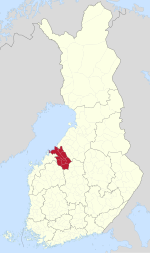 Central Ostrobothnia on a map of Finland | |
| Coordinates: 63°30′N 24°15′E / 63.500°N 24.250°E / 63.500; 24.250 | |
| Country | Finland |
| Historical province | Ostrobothnia |
| Capital | Kokkola |
| Area | |
| • Total | 5,706.39 km2 (2,203.25 sq mi) |
| Population (2019) | |
| • Total | 68,158 |
| • Density | 12/km2 (31/sq mi) |
| GDP | |
| • Total | €2.425 billion (2015) |
| • Per capita | €35,181 (2015) |
| Time zone | UTC+2 (EET) |
| • Summer (DST) | UTC+3 (EEST) |
| ISO 3166 code | FI-07 |
| NUTS | 1A1 |
| Regional bird | Skylark (Alauda arvensis) |
| Regional fish | European whitefish (Coregonus lavaretus) |
| Regional flower | Bluebell (Harebell) |
| Regional stone | Gneiss |
| Regional lake | Lake Lestijärvi |
| Website | keski-pohjanmaa.fi |
Central Ostrobothnia (Finnish: Keski-Pohjanmaa; Swedish: Mellersta Österbotten) is a region in Finland. It borders the regions of Ostrobothnia, North Ostrobothnia, Central Finland and South Ostrobothnia.[2]
Historical provinces
Municipalities
The region of Central Ostrobothnia consists of eight municipalities, two of which have city status (marked in bold).
Sub-regions


List of municipalities
| Coat of arms | Municipality | Population | Land area (km2) | Density (/km2) | Finnish speakers | Swedish speakers | Other speakers |
|---|---|---|---|---|---|---|---|
 | Halsua | 1,013 | 413 | 2 | 94 % | 0.5 % | 5 % |
 | Kannus | 5,246 | 468 | 11 | 97 % | 0.4 % | 3 % |
 | Kaustinen | 4,137 | 354 | 12 | 95 % | 1.8 % | 3 % |
 | Kokkola | 48,295 | 1,446 | 33 | 83 % | 12 % | 5 % |
 | Lestijärvi | 682 | 480 | 1 | 98 % | 0.1 % | 1 % |
 | Perho | 2,578 | 748 | 3 | 98 % | 0.5 % | 1 % |
 | Toholampi | 2,849 | 609 | 5 | 98 % | 0.1 % | 2 % |
 | Veteli | 2,936 | 502 | 6 | 95 % | 1.7 % | 3 % |
| Total | 67,736 | 5,020 | 13 | 87 % | 9 % | 4 % |
Politics
Results of the 2019 Finnish parliamentary election in Central Ostrobothnia:
- Centre Party 31.09%
- Finns Party 19.60%
- Social Democratic Party 16.06%
- National Coalition Party 7.42%
- Christian Democrats 7.29%
- Swedish People's Party 6.26%
- Green League 6.03%
- Left Alliance 4.11%
- Blue Reform 0.80%
- Seven Star Movement 0.36%
- Other parties 0.98%
References
External links
Wikimedia Commons has media related to Central Ostrobothnia.
- Central Ostrobothnia Regional Council website
- v
- t
- e
- Åland
- Central Finland
- Central Ostrobothnia
- Kainuu
- Kymenlaakso
- Lapland
- North Karelia
- North Ostrobothnia
- North Savo
- Ostrobothnia
- Päijät-Häme
- Pirkanmaa
- Satakunta
- South Karelia
- South Ostrobothnia
- South Savo
- Southwest Finland
- Kanta-Häme
- Uusimaa

| Authority control databases: Geographic |
|
|---|


