Borger-Odoorn
Municipality in Drenthe, Netherlands

Flag

Coat of arms

Location in Drenthe
(January 2021)[5]
Parts of 7800 and 9500 range
Borger-Odoorn (Dutch pronunciation: [ˌbɔrɣər oːˈdoːr(ə)n] ⓘ) is a municipality in the northeastern Netherlands in the province of Drenthe.
The local Hunebedcentrum Borger features several megaliths (or 'hunebeds') associated with the neolithic and mesolithic Funnelbeaker culture, as well as recreations of historical houses.
Population centers
Topography

Dutch Topographic map of the municipality of Borger-Odoorn, June 2015.
Notable people

- Albert Meems (1888 in Nieuw-Buinen – after 1957) a Dutch spy for Germany in the Second World War
- Pieter van Boven (1898 – 1952) a Dutch fencer, competed at the 1924 Summer Olympics
- Egbert Schuurman (born 1937 in Borger) a Dutch engineer, philosopher and politician
- Henk Nienhuis (1941 in Nieuw-Buinen – 2017) a Dutch footballer and manager.
- Henk G. Sol (born 1951 in Borger) a Dutch organizational theorist and academic
- Carsten de Dreu (born 1966 in Borger) Professor of Psychology at Leiden University and Behavioral Economics at the University of Amsterdam
Gallery
-
 Zuiderdiep123 gereformeerde kerk Tweede Exloermond
 -
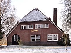 Boerderij Zuiderdiep309 Valthermond
 -
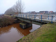 Valthermond spoor
 -
 Trafohuisje Hoofdstraat Buinen
 -
 Odoorn
 -
 Megalith at Hunebedcentrum Borger
 -
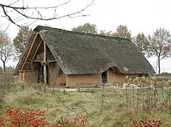 Reconstruction of a Funnelbeaker house


References
- ^ "Gemeentelijke indeling op 1 januari 1998" [Municipal divisions on 1 January 1998]. cbs.nl (in Dutch). CBS. Retrieved 5 October 2013.
- ^ "Burgemeester en wethouders" [Mayor and aldermen] (in Dutch). Gemeente Borger-Odoorn. Archived from the original on 17 November 2020. Retrieved 5 October 2013.
- ^ "Kerncijfers wijken en buurten 2020" [Key figures for neighbourhoods 2020]. StatLine (in Dutch). CBS. 24 July 2020. Retrieved 19 September 2020.
- ^ "Postcodetool for 7875AD". Actueel Hoogtebestand Nederland (in Dutch). Het Waterschapshuis. Retrieved 5 October 2013.
- ^ "Bevolkingsontwikkeling; regio per maand" [Population growth; regions per month]. CBS Statline (in Dutch). CBS. 1 January 2021. Retrieved 2 January 2022.
External links
- Official website
Places adjacent to Borger-Odoorn | ||||||||||||||||
|---|---|---|---|---|---|---|---|---|---|---|---|---|---|---|---|---|
| ||||||||||||||||


Authority control databases | |
|---|---|
| International |
|
| Geographic |
|
 | This Drenthe location article is a stub. You can help Wikipedia by expanding it. |
- v
- t
- e


