Bernam River
River in Perak and Selangor, Malaysia

The Bernam River (Malay: Sungai Bernam, Jawi: سوڠاي برنم) is a river located between the Malaysian states of Perak and Selangor, demarcating the border of the two states. The river also separates the respective districts of Muallim and Bagan Datuk on the north and Hulu Selangor and Sabak Bernam in the south.
Course


 FT 5)
FT 5)The Bernam River flows from Mount Liang Timur (Mount Liang East) in the east on the Titiwangsa Mountains to the Straits of Malacca in the west.[1]
The eastern part of the river is suitable for palm oil and rubber tree plantation, while swamps fill the western areas. A percentage of the swampy areas have been reclaimed and dried up by a drainage system. Some the reclaimed area has been converted into paddy fields.
Historical importance
Archeologists have discovered several archaeological sites along the river, where ancient artifacts were found. Excavation works had been carried out by experts from various local universities and Muzium Sultan Alam Shah.
Towns along the river basin
- Tanjong Malim
- Ulu Bernam
- Behrang
- Slim River
- Sabak
- Sungai Ayer Tawar
- Bagan Nakhoda Omar
- Hutan Melintang
- Bagan Datuk
-
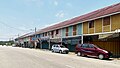
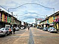
 Tanjong Malim
 -
 Sabak
Sabak -
 Bagan Datuk


See also
References
- ^ "Sukar bina jambatan seberang Sungai Bernam". Utusan Online (in Malay). 17 July 2008. Archived from the original on 5 March 2016. Retrieved 23 October 2015.
3°51′N 100°49′E / 3.850°N 100.817°E / 3.850; 100.817
- v
- t
- e
 | This Perak location article is a stub. You can help Wikipedia by expanding it. |
- v
- t
- e
 | This article related to a river in Malaysia is a stub. You can help Wikipedia by expanding it. |
- v
- t
- e


