Beesley's Point, New Jersey
Populated place in Cape May County, New Jersey, US
Census-designated place in New Jersey, United States
39°16′36″N 74°38′11″W / 39.27667°N 74.63639°W / 39.27667; -74.63639 United States
 New Jersey
 (2020)[3]
Beesley's Point is an unincorporated community and census-designated place (CDP)[5] in Upper Township, in Cape May County, in the U.S. state of New Jersey.[6] Beesley's Point is on Peck Bay across from Ocean City. Beesley's Point is home to the Beesley's Point Generating Station and one end of the now-closed Beesley's Point Bridge.
It was first listed as a CDP in the 2020 census[2] with a population of 816.[3]
A post office was established in 1851, with Joseph Chatten as the first postmaster.[7]
Demographics
| Census | Pop. | Note | %± |
|---|---|---|---|
| 2020 | 816 | — | |
| U.S. Decennial Census[8] 2020[3] | |||
2020 census
| Race / Ethnicity | Pop 2020[9] | % 2020 |
|---|---|---|
| White alone (NH) | 723 | 88.60% |
| Black or African American alone (NH) | 2 | 0.25% |
| Native American or Alaska Native alone (NH) | 2 | 0.25% |
| Asian alone (NH) | 5 | 0.61% |
| Pacific Islander alone (NH) | 1 | 0.12% |
| Some Other Race alone (NH) | 3 | 0.37% |
| Mixed Race/Multi-Racial (NH) | 30 | 3.68% |
| Hispanic or Latino (any race) | 50 | 6.13% |
| Total | 816 | 100.00% |
Education
As with other parts of Upper Township, the area is zoned to Upper Township School District (for grades K-8) and Ocean City School District (for high school). The latter operates Ocean City High School.
Countywide schools include Cape May County Technical High School and Cape May County Special Services School District.
The community had once had its own school.[10]
References
- ^ "ArcGIS REST Services Directory". United States Census Bureau. Retrieved October 11, 2022.
- ^ a b c "Beesleys Point Census Designated Place". Geographic Names Information System. United States Geological Survey, United States Department of the Interior.
- ^ a b c Census Data Explorer: Beesleys Point CDP, New Jersey, United States Census Bureau. Accessed June 15, 2023.
- ^ Geographic Codes Lookup for New Jersey, Missouri Census Data Center. Accessed June 9, 2023.
- ^ State of New Jersey Census Designated Places - BVP20 - Data as of January 1, 2020, United States Census Bureau. Accessed December 1, 2022.
- ^ Locality Search, State of New Jersey. Accessed June 9, 2016.
- ^ Stevens, Lewis Townsend (1897). The History of Cape May County, New Jersey: From the Aboriginal Times to the Present Day. Star of the Cape Publishing Co. p. 467.
- ^ "Decennial Census of Population and Housing by Decade". United States Census Bureau.
- ^ "P2 HISPANIC OR LATINO, AND NOT HISPANIC OR LATINO BY RACE - 2020: DEC Redistricting Data (PL 94-171) - Beesley's Point CDP, New Jersey". United States Census Bureau.
- ^ "School House, Beesleys Point, Cape May County, NJ". Library of Congress. Retrieved June 6, 2021.
Wikimedia Commons has media related to Beesley's Point, New Jersey.
- v
- t
- e
- Upper Township School District (for K-8)
- Ocean City School District (for high school)
- Beesley's Point Bridge
- Thomas Beesley Sr. House
- Tuckahoe station
- Palermo Air Force Station (former)
Municipalities and communities of Cape May County, New Jersey, United States | ||
|---|---|---|
County seat: Cape May Court House | ||
| Cities | 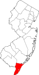 | |
| Boroughs | ||
| Townships | ||
| CDPs | ||
| Other communities | ||
| ||
 | This Cape May County, New Jersey state location article is a stub. You can help Wikipedia by expanding it. |
- v
- t
- e


