Bartenheim
Commune in Grand Est, France
Commune in Grand Est, France
Bartenheim Bàrtene | ||
|---|---|---|
Commune | ||
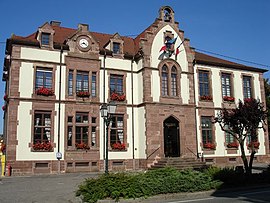 Town hall of Bartenheim | ||
 Coat of arms | ||
Location of Bartenheim  | ||
(2020–2026) Bernard Kannengieser[1] | | |
| Area 1 | 12.86 km2 (4.97 sq mi) | |
| Population (2021)[2] | 4,102 | |
| • Density | 320/km2 (830/sq mi) | |
| Time zone | UTC+01:00 (CET) | |
| • Summer (DST) | UTC+02:00 (CEST) | |
| INSEE/Postal code | 68021 /68870 | |
| Elevation | 237–311 m (778–1,020 ft) (avg. 260 m or 850 ft) | |
| 1 French Land Register data, which excludes lakes, ponds, glaciers > 1 km2 (0.386 sq mi or 247 acres) and river estuaries. | ||
Bartenheim (French pronunciation: [baʁtənaim] ⓘ; Alsatian: Bàrtana[3]) is a commune in the Haut-Rhin department in Alsace in north-eastern France.[4]
It is situated northwest of the EuroAirport Basel-Mulhouse-Freiburg, on the eastern edge of Sundgau. Bartenheim station has rail connections to Mulhouse and Basel.
Population
| Year | Pop. | ±% p.a. |
|---|---|---|
| 1968 | 2,014 | — |
| 1975 | 2,413 | +2.62% |
| 1982 | 2,452 | +0.23% |
| 1990 | 2,483 | +0.16% |
| 1999 | 2,913 | +1.79% |
| 2007 | 3,469 | +2.21% |
| 2012 | 3,806 | +1.87% |
| 2017 | 3,837 | +0.16% |
| Source: INSEE[5] | ||
See also
References
- ^ "Répertoire national des élus: les maires". data.gouv.fr, Plateforme ouverte des données publiques françaises (in French). 2 December 2020.
- ^ "Populations légales 2021". The National Institute of Statistics and Economic Studies. 28 December 2023.
- ^ "Elsàssischi Ortsnàmme".
- ^ INSEE commune file
- ^ Population en historique depuis 1968, INSEE
Wikimedia Commons has media related to Bartenheim.
- v
- t
- e
 Communes of the Haut-Rhin department
- Algolsheim
- Altenach
- Altkirchsubpr
- Ammerschwihr
- Andolsheim
- Appenwihr
- Artzenheim
- Aspach
- Aspach-le-Bas
- Aspach-Michelbach
- Attenschwiller
- Aubure
- Baldersheim
- Balgau
- Ballersdorf
- Balschwiller
- Baltzenheim
- Bantzenheim
- Bartenheim
- Battenheim
- Beblenheim
- Bellemagny
- Bendorf
- Bennwihr
- Berentzwiller
- Bergheim
- Bergholtz
- Bergholtzzell
- Bernwiller
- Berrwiller
- Bettendorf
- Bettlach
- Biederthal
- Biesheim
- Biltzheim
- Bischwihr
- Bisel
- Bitschwiller-lès-Thann
- Blodelsheim
- Blotzheim
- Bollwiller
- Le Bonhomme
- Bourbach-le-Bas
- Bourbach-le-Haut
- Bouxwiller
- Bréchaumont
- Breitenbach-Haut-Rhin
- Bretten
- Brinckheim
- Bruebach
- Brunstatt-Didenheim
- Buethwiller
- Buhl
- Burnhaupt-le-Bas
- Burnhaupt-le-Haut
- Buschwiller
- Carspach
- Cernay
- Chalampé
- Chavannes-sur-l'Étang
- Colmarpref
- Courtavon
- Dannemarie
- Dessenheim
- Diefmatten
- Dietwiller
- Dolleren
- Durlinsdorf
- Durmenach
- Durrenentzen
- Eglingen
- Eguisheim
- Elbach
- Emlingen
- Ensisheim
- Eschbach-au-Val
- Eschentzwiller
- Eteimbes
- Falkwiller
- Feldbach
- Feldkirch
- Fellering
- Ferrette
- Fessenheim
- Fislis
- Flaxlanden
- Folgensbourg
- Fortschwihr
- Franken
- Fréland
- Friesen
- Frœningen
- Fulleren
- Galfingue
- Geishouse
- Geispitzen
- Geiswasser
- Gildwiller
- Goldbach-Altenbach
- Gommersdorf
- Griesbach-au-Val
- Grussenheim
- Gueberschwihr
- Guebwiller
- Guémar
- Guevenatten
- Guewenheim
- Gundolsheim
- Gunsbach
- Habsheim
- Hagenbach
- Hagenthal-le-Bas
- Hagenthal-le-Haut
- Hartmannswiller
- Hattstatt
- Hausgauen
- Le Haut-Soultzbach
- Hecken
- Hégenheim
- Heidwiller
- Heimersdorf
- Heimsbrunn
- Heiteren
- Heiwiller
- Helfrantzkirch
- Herrlisheim-près-Colmar
- Hésingue
- Hettenschlag
- Hindlingen
- Hirsingue
- Hirtzbach
- Hirtzfelden
- Hochstatt
- Hohrod
- Hombourg
- Horbourg-Wihr
- Houssen
- Hunawihr
- Hundsbach
- Huningue
- Husseren-les-Châteaux
- Husseren-Wesserling
- Illfurth
- Illhaeusern
- Illtal
- Illzach
- Ingersheim
- Issenheim
- Jebsheim
- Jettingen
- Jungholtz
- Kappelen
- Katzenthal
- Kaysersberg Vignoble
- Kembs
- Kiffis
- Kingersheim
- Kirchberg
- Knœringue
- Kœstlach
- Kœtzingue
- Kruth
- Kunheim
- Labaroche
- Landser
- Lapoutroie
- Largitzen
- Lautenbach
- Lautenbachzell
- Lauw
- Leimbach
- Levoncourt
- Leymen
- Liebenswiller
- Liebsdorf
- Lièpvre
- Ligsdorf
- Linsdorf
- Linthal
- Logelheim
- Lucelle
- Luemschwiller
- Luttenbach-près-Munster
- Lutter
- Lutterbach
- Magny
- Magstatt-le-Bas
- Magstatt-le-Haut
- Malmerspach
- Manspach
- Masevaux-Niederbruck
- Mertzen
- Merxheim
- Metzeral
- Meyenheim
- Michelbach-le-Bas
- Michelbach-le-Haut
- Mittelwihr
- Mittlach
- Mitzach
- Mœrnach
- Mollau
- Montreux-Jeune
- Montreux-Vieux
- Moosch
- Mooslargue
- Morschwiller-le-Bas
- Muespach
- Muespach-le-Haut
- Muhlbach-sur-Munster
- Mulhousesubpr
- Munchhouse
- Munster
- Muntzenheim
- Munwiller
- Murbach
- Nambsheim
- Neuf-Brisach
- Neuwiller
- Niederentzen
- Niederhergheim
- Niedermorschwihr
- Niffer
- Oberbruck
- Oberentzen
- Oberhergheim
- Oberlarg
- Obermorschwihr
- Obermorschwiller
- Obersaasheim
- Oderen
- Oltingue
- Orbey
- Orschwihr
- Osenbach
- Ostheim
- Ottmarsheim
- Petit-Landau
- Pfaffenheim
- Pfastatt
- Pfetterhouse
- Porte du Ried
- Pulversheim
- Raedersdorf
- Raedersheim
- Rammersmatt
- Ranspach
- Ranspach-le-Bas
- Ranspach-le-Haut
- Rantzwiller
- Réguisheim
- Reiningue
- Retzwiller
- Ribeauvillé
- Richwiller
- Riedisheim
- Riespach
- Rimbach-près-Guebwiller
- Rimbach-près-Masevaux
- Rimbachzell
- Riquewihr
- Rixheim
- Roderen
- Rodern
- Roggenhouse
- Romagny
- Rombach-le-Franc
- Roppentzwiller
- Rorschwihr
- Rosenau
- Rouffach
- Ruederbach
- Ruelisheim
- Rumersheim-le-Haut
- Rustenhart
- Saint-Amarin
- Saint-Bernard
- Saint-Cosme
- Sainte-Croix-aux-Mines
- Sainte-Croix-en-Plaine
- Sainte-Marie-aux-Mines
- Saint-Hippolyte
- Saint-Louis
- Saint-Ulrich
- Sausheim
- Schlierbach
- Schweighouse-Thann
- Schwoben
- Sentheim
- Seppois-le-Bas
- Seppois-le-Haut
- Sewen
- Sickert
- Sierentz
- Sondernach
- Sondersdorf
- Soppe-le-Bas
- Soultzbach-les-Bains
- Soultzeren
- Soultz-Haut-Rhin
- Soultzmatt
- Spechbach
- Staffelfelden
- Steinbach
- Steinbrunn-le-Bas
- Steinbrunn-le-Haut
- Steinsoultz
- Sternenberg
- Stetten
- Storckensohn
- Stosswihr
- Strueth
- Sundhoffen
- Tagolsheim
- Tagsdorf
- Thannsubpr
- Thannenkirch
- Traubach-le-Bas
- Traubach-le-Haut
- Turckheim
- Ueberstrass
- Uffheim
- Uffholtz
- Ungersheim
- Urbès
- Urschenheim
- Valdieu-Lutran
- Vieux-Ferrette
- Vieux-Thann
- Village-Neuf
- Vœgtlinshoffen
- Vogelgrun
- Volgelsheim
- Wahlbach
- Walbach
- Waldighofen
- Walheim
- Waltenheim
- Wasserbourg
- Wattwiller
- Weckolsheim
- Wegscheid
- Wentzwiller
- Werentzhouse
- Westhalten
- Wettolsheim
- Wickerschwihr
- Widensolen
- Wihr-au-Val
- Wildenstein
- Willer
- Willer-sur-Thur
- Winkel
- Wintzenheim
- Wittelsheim
- Wittenheim
- Wittersdorf
- Wolfersdorf
- Wolfgantzen
- Wolschwiller
- Wuenheim
- Zaessingue
- Zellenberg
- Zillisheim
- Zimmerbach
- Zimmersheim
- pref: prefecture
- subpr: subprefecture
Authority control databases | |
|---|---|
| International |
|
| National |
|
 | This Haut-Rhin geographical article is a stub. You can help Wikipedia by expanding it. |
- v
- t
- e


