Aurès Mountains
Mountain range in Algeria
35°19′05″N 6°38′13″E / 35.31806°N 6.63694°E / 35.31806; 6.63694The Aures Mountains (Arabic: جبال الأوراس, known in antiquity as Latin: Aurasius Mons) are a subrange of the Saharan Atlas in northeastern Algeria.[1] The mountain range gives its name to the mountainous natural and historical region of the Aures.
Geography
The Aures mountains are the eastern continuation of the Saharan Atlas. The highest peak in the Aurès mountain range is Djebel Chélia in Khenchela Province, which sits at 2,328 metres (7,638 ft).
The Belezma Range is a northwestern prolongation of the Aures Mountains located where the Tell Atlas and the Saharan Atlas come together. Its main summits are 2,178 m (7,146 ft) high Djebel Refaâ and 2,136 m (7,008 ft) high Djebel Tichaou.[2] The Atlas chain of mountains extends over 1000 kilometers in total over Northern Africa.
History
Historically, the Aures served as a refuge and bulwark for the Berber tribes, forming a base of resistance against the Romans, Vandals, Byzantine, and Arabs along the centuries.[3]
The mountain area was also a district of French Algeria that existed during and after the Algerian War of Independence from 1954 to 1962. It was in this region that the Algerian War of Independence was started by Berber freedom fighters. The rugged terrain of the Aures makes it still one of the least developed areas in the Maghreb.
Population
In eastern Algeria, the Aures is a large Berber-speaking region, home of the Chaoui people. The Chaoui eastern Berber population practices traditional transhumance, farming fixed stone terraces in the mountains where they grow sorghum, as well as other grains and vegetables. Seasonally they move their cattle to relatively warm areas in the lowland valleys where they pitch tents or live in other temporary structures and tend livestock through the winter.[4]
Features
-
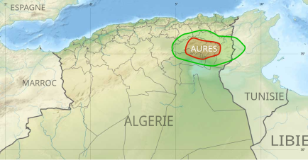 Location of the Aures region in Algeria
 -
 View of one of the mountains of the Belezma Range, a western subrange of the Aures
 -
 Landscape of southern area of the range


See also
References
- ^ "Aurès - mountains, Algeria". Encyclopedia Britannica. 20 Jul 1998. Retrieved 8 Apr 2023.
- ^ Belezma National Park - Travel to Algeria
- ^ Conant, Jonathan (2012). Staying Roman : conquest and identity in Africa and the Mediterranean, 439–700. Cambridge New York: Cambridge University Press. pp. 280–281. ISBN 0521196973.
- ^ La vie économique du Chaouia de l'Aures
External links
Wikimedia Commons has media related to Aurès Mountains.
- Les Aurès - Algérie (French). Includes many photos of the region.
- v
- t
- e

- Blidean Atlas
- Babor Mountains
- Beni-Chougrane
- Bibans
- Bouzegza Mount [ar]
- Constantine Mountains
- Chenoua Mount
- Dahra Range
- Djurdjura
- Edough
- Khachna
- Kroumirie
- Ouarsenis
- Medjerda Mountains
- Murdjajo
- Numidian Range
- Saïda Mountains
- Tlemcen Mountains
- Titteri
- Tessala Range
- Trara
- Yemma Gouraya
- Amour Range
- Aurès Mountains
- Belezma Range
- Hodna Mountains
- Ksour Range
- Ouled Naïl Range
- Nememcha Range
- Zab Mountains
- Achaoun
- Anneb
- Djebel Antar
- Djebel Azao
- Djebel Chélia
- Djebel Grouz
- Djebel Guetiane
- Djebel Tsili
- Koudiat Béni Arif
- Koudiat Sidi Abdelkader
- Lalla Khedidja
- Maouna
- Mount Babor
- Mount Bissa
- Mount Issa
- Mount Tahat
- Mount Tamgout
- Mount Zaccar
- Pic des Singes
- Taourirt Tan Afella
- Thaletat
Authority control databases | |
|---|---|
| International |
|
| National |
|
| Geographic |
|
| Other |
|


