Abbottabad Tehsil
Tehsil in Khyber Pakhtunkhwa, Pakistan
Abbottabad Tehsil تحصیل ایبٹ آباد | |
|---|---|
Tehsil | |
 | |
| Country |  Pakistan Pakistan |
| Province |  Khyber Pakhtunkhwa Khyber Pakhtunkhwa |
| District | Abbottabad |
| Headquarters | Abbottabad |
| Population (2017)[1] | |
| • Tehsil | 981,590 |
| • Urban | 244,842 |
| • Rural | 736,748 |
| Time zone | UTC+5 (PST) |
| Number of towns | 1 |
| Number of Union Councils | 35 |
Abbottabad Tehsil (Urdu: تحصیل ایبٹ آباد) is an administrative subdivision (tehsil) of Abbottabad District in the Khyber Pakhtunkhwa province of Pakistan.
History
During the British rule, the current district of Abbottabad was created as a Tehsil of Hazara District.[2] After Pakistan′s independence from Britain on 14 August 1947, it remained a tehsil of Hazara until 1981 when the old Abbottabad Tehsil became a district, containing two tehsils - Abbottabad and Havelian.
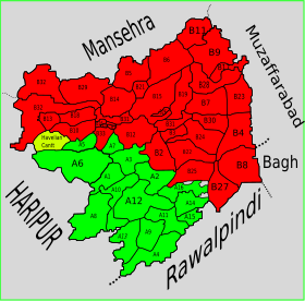
Subdivisions
Municipal Committees
- Abbottabad (Headquarters)
Cantonments
- Abbottabad Cantonment
- Murree Gallies Cantonment
Town Councils
Union Councils
- Bagan
- Bagh
- Bagnotar
- Bakot
- Bal Dheri
- Banda Qazi
- Bandi Dhundan
- Biran Gali
- Birot Kalan
- Birot Khurd
- Boi
- Chamhad
- Chatri
- Dahamtore
- Galiat
- Gojri Union Council
- Dalola
- Jarral
- Jhangi
- Kakol
- Kakot
- Kassaki Kalan
- Kokmang
- Kothiala
- Lakhala
- Malach
- Moolia
- Mir Pur
- Nagaki
- Nagri Bala
- Namal
- Namli Mera
- Nawan Shehr Janubi
- Nawan Shehr Shumali
- Palak
- Pattan Kalan
- Pawa
- Phal Kot
- Pind Kargoo Khan
- Qasba Abbatabad
- Rach Behn
- Rialah
- Salhad
- Seri Shehr Shah
- Sheikhul Bandi
- Sherwan
- Sir Bhanna
- Tar Nawai
References
- ^ "DISTRICT AND TEHSIL LEVEL POPULATION SUMMARY WITH REGION BREAKUP: KHYBER PAKHTUNKHWA" (PDF). Pakistan Bureau of Statistics. 2021-03-19. Archived (PDF) from the original on 2019-08-04. Retrieved 2018-04-17.
- ^ Abbottābād Tahsīl - Imperial Gazetteer of India, v. 5, p. 1
- v
- t
- e
Administrative divisions of Abbottabad District

- Abbottabad
- Havelian
- Bagan
- Bagh
- Bagnotar
- Bakot
- Bal Dheri
- Banda Qazi
- Bandi Dhundan
- Biran Gali
- Birot Kalan
- Birot Khurd
- Boi
- Chamhad
- Chatri
- Dahamtore
- Galiat
- Gojri Union Council
- Dalola
- Jarral
- Jhangi
- Kakol
- Kakot
- Kassaki Kalan
- Kokmang
- Kothiala
- Lakhala
- Malach
- Moolia
- Mir Pur
- Nagaki
- Nagri Bala
- Namal
- Namli Mera
- Nawan Shehr Janubi
- Nawan Shehr Shumali
- Palak
- Pattan Kalan
- Pawa
- Phal Kot
- Pind Kargoo Khan
- Qasba Abbatabad
- Rach Behn
- Rialah
- Salhad
- Sheikhul Bandi
- Sherwan
- Sir Bhanna
- Tar Nawai
Tehsils of Khyber Pakhtunkhwa | |||||||||||||||||||
|---|---|---|---|---|---|---|---|---|---|---|---|---|---|---|---|---|---|---|---|
| Bannu |
| ||||||||||||||||||
| Dera Ismail Khan |
| ||||||||||||||||||
| Hazara |
| ||||||||||||||||||
| Kohat |
| ||||||||||||||||||
| Malakand |
| ||||||||||||||||||
| Mardan |
| ||||||||||||||||||
| Peshawar |
| ||||||||||||||||||
34°12′30″N 73°28′59″E / 34.2083°N 73.4831°E / 34.2083; 73.4831
 | This Abbottabad District location article is a stub. You can help Wikipedia by expanding it. |
- v
- t
- e


