Jervis-Bay-Nationalpark
| Jervis-Bay-Nationalpark NSW | |||
|---|---|---|---|
 | |||
| |||
| Lage: | New South Wales, Australien | ||
| Besonderheit: | Aborigines-Kultur | ||
| Fläche: | 48,54 km² | ||
| Gründung: | 1995 | ||
 | |||
| i2i3i6 | |||


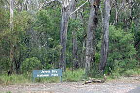
Der Jervis-Bay-Nationalpark (NSW) ist ein Nationalpark im Süden von New South Wales, Australien im Gebiet der Jervis Bay. Er liegt bei der Kleinstadt Huskisson etwa 20 Kilometer südöstlich von Nowra und grenzt zum Teil an das Jervis Bay Territory, den sich dort befindenden Booderee-Nationalpark sowie den Jervis-Bay-Marinepark. Er umfasst mehrere, nicht zusammenhängende Areale auf der Nord- und Westseite der Bucht.
Der Park wurde 1995 angelegt und umfasst 48,54 Quadratkilometer.[1] Der angrenzende Booderee-Nationalpark trug bis 1996 den Namen Jervis Bay National Park.[2]
Der Park wird vom New South Wales Department of Environment and Climate Change verwaltet.
Die Einrichtungen umfassen in verschiedenen Teilen des Parks Wanderwege sowie Picknickplätze. Die Küste des Parks eignet sich für Wassersport und Walbeobachtung.
Weblinks
- Offizielle Webpräsenz des Office of Environment & Heritage. NSW National Parks and Wildlife Service
- Offizielle Webpräsenz des NSW National Parks and Wildlife Service mit Besucherinformationen
- Shoalhaven i-news
Einzelnachweise
- ↑ Jervis Bay National Park. Park Management. In: Office of Environment and Heritage. New South Wales National Parks & Wildlife Service, abgerufen am 18. Januar 2013 (englisch): „This park was created in March 1995. It covers an area of 4,854 hectares.“
- ↑ Booderee National Park – European history. In: Department of Sustainability, Environment, Water, Population and Communities. 21. November 2012, abgerufen am 18. Januar 2013 (englisch): „Subsequently, title to the Jervis Bay National Park and the Jervis Bay Botanic Gardens was conferred on the Wreck Bay Aboriginal Community Council, provided these areas were leased back to the Director of National Parks, to be managed as a national park and botanic gardens. […] The Booderee National Park Board of Management was first established in 1996 under the parks Act.“

Nationalparks in New South Wales (Australien)
A Abercrombie River | Arakoon | Arakwal | B Bago Bluff | Bald Rock | Bangadilly | Barakee | Barool | Barrington Tops | Basket Swamp | Belford | Bellinger River | Benambra | Bendick | Ben Halls Gap | Beowa | Berowra | Bimberamala | Bindarri | Biriwal-Bulga | Blue Mountains | Bongil Bongil | Boonoo-Boonoo | Booti-Booti | Border Ranges | Botany Bay | Bouddi | Bournda | Brindabella | Brisbane Water | Broadwater | Budawang | Budderoo | Bugong | Bundjalung | Bungawalbin | Bungonia | Butterleaf | C Capoompeta | Carrai | Cascade | Cataract | Cathedral Rock | Cattai | Chaelundi | Clyde River | Cocoparra | Columbey | Conimbla | Conjola | Coolah Tops | Coorabakh | Cottan-Bimbang | Crowdy Bay | Culgoa | Cunnawarra | Curracabundi | D Dharawal | Deua | Dharug | Dooragan | Dorrigo | Dunggir | E Eurobodalla | F Fortis Creek | G Gaagal Wanggaan | Gardens of Stone | Garigal | Garrawilla | Georges River | Ghin Doo Ee | Gibraltar Range | Gir-um-bit | Gondwana-Regenwälder | Goobang | Goolawah | Goonengerry | Goulburn River | Gourock | Gulaga | Gumbaynggirr | Gundabooka | Guy Fawkes River | H Hat Head | Heathcote | Hunter Wetlands | I Indwarra | J Jerrawangala | Jervis Bay | Junuy Juluum | K Kalyarr | Kanangra-Boyd | Karuah | Kemendok | Keverstone | Kinchega | Kings Plains | Kooraban | Koreelah | Kosciuszko | Kumbatine | Ku-ring-gai-Chase | Kwiambal | L Lachlan Valley | Lane Cove | Livingstone | M Macquarie Pass | Mallanganee | Mallee Cliffs | Mares Forest | Maria | Marramarra | Marrangaroo | Maryland | Mebbin | Meroo | Middle-Brother | Mimosa Rocks | Minjary | Monga | Mooball | Morton | Mount Clunie | Mount Imlay | Mount Jerusalem | Mount Kaputar | Mount Nothofagus | Mount Pikapene | Mount Royal | Mount Warning | Mummel Gulf | Mungo | Murramarang | Murray Valley | Mutawintji | Myall Lakes | N Nangar | Nattai | New England | Nightcap | Nowendoc | Nymboi-Binderay | Nymboida | O Oolambeyan | Oxley-Wild-Rivers | P Paroo-Darling | Popran | R Ramornie | Richmond Range | Royal | S Saltwater | Scheyville | Scone Mountain | Seven Mile Beach | Single | South East Forest | Sturt | Sydney Harbour | T Tallaganda | Tapin Tops | Tarlo River | Thirlmere Lakes | Tilligerry | Timbarra | Tomaree | Tooloom | Toonumbar | Toorale | |Towarri | Turon | U Ulidarra | W Wadbilliga | Wallarah | Wallaroo | Wallingat | Warra | Warrabah | Warrumbungle | Washpool | Watagans | Weddin Mountains | Werakata | Werrikimbe | Willandra | Willi-Willi | Woko | Wollemi | Wollumbin | Woolooma | Woomargama | Worimi | Wyrrabalong | Y Yabbra | Yanga | Yanununbeyan | Yarriabini | Yarrahapinni Wetlands | Yengo | Yuraygir


