Chincoteague (Virginia)
| Chincoteague | |||
|---|---|---|---|
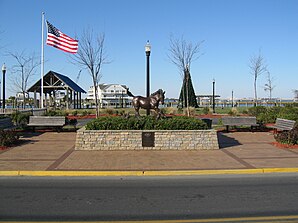 Statue von Misty of Chincoteague | |||
Siegel | |||
| Lage in Virginia | |||
| |||
| Basisdaten | |||
| Gründung: | 1908 | ||
| Staat: | Vereinigte Staaten | ||
| Bundesstaat: | Virginia | ||
| County: | Accomack County | ||
| Koordinaten: | 37° 56′ N, 75° 22′ W37.934722222222-75.3677777777781Koordinaten: 37° 56′ N, 75° 22′ W | ||
| Zeitzone: | Eastern (UTC−5/−4) | ||
| Einwohner: | 3.344 (Stand: 2020) | ||
| Haushalte: | 1.658 (Stand: 2020) | ||
| Fläche: | 96 km² (ca. 37 mi²) davon 71,1 km² (ca. 27 mi²) Land | ||
| Bevölkerungsdichte: | 47 Einwohner je km² | ||
| Höhe: | 1 m | ||
| Postleitzahl: | 23336 | ||
| Vorwahl: | +1 757 | ||
| FIPS: | 51-16512 | ||
| GNIS-ID: | 2390792 | ||
| Website: | www.chincoteague-va.gov | ||
| Bürgermeister: | J. Arthur Leonard[1] | ||
Statue eines Chincoteague Ponys an der Hauptstraße | |||
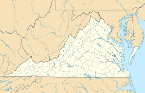

Chincoteague (IPA: /ˌʃɪŋkəˈtiːɡ/ oder /ˈʃɪŋkətiːɡ/) ist eine US-amerikanische Kleinstadt auf der Insel Chincoteague Island im Landkreis Accomack County, Virginia auf der Delmarva-Halbinsel. Chincoteague ist ein Lehnwort aus den Algonkin-Sprachen.
Das U.S. Census Bureau hat bei der Volkszählung 2020 eine Einwohnerzahl von 3.344[2] ermittelt. Die Fläche der Ortschaft beträgt 96,0 km². Nach dem Ort sind die Assateague-Ponys (Chincoteague Ponys) benannt, die auf Assateague Island leben. Die Insel Chincoteague Island hat eine Fläche von 55,4 km².
Nahe der Stadt befand sich die Naval Auxiliary Air Station (NAAS) Chincoteague, Teil davon war die Naval Aviation Ordnance Test Station (NAOTS), auf der verschiedene Waffensysteme und Raketen entwickelt und getestet wurden.
Weblinks
Commons: Chincoteague Island (Virginia) – Sammlung von Bildern, Videos und Audiodateien
- Chincoteague Island in photos
Einzelnachweise
- ↑ chincoteague-va.gov. (abgerufen am 8. Mai 2024).
- ↑ Explore Census Data Chincoteague town, Virginia. Abgerufen am 16. Januar 2023.
County Seat: Accomac
| Towns: | Accomac • Belle Haven1 • Bloxom • Chincoteague • Hallwood • Keller • Melfa • Onancock • Onley • Painter • Parksley • Saxis • Tangier • Wachapreague | |
| CDPs: | Atlantic • Bayside • Bobtown • Boston • Captains Cove • Cats Bridge • Chase Crossing • Deep Creek • Gargatha • Greenbackville • Greenbush • Harborton • Horntown • Lee Mont • Locust Mount • Makemie Park • Mappsburg • Mappsville • Metompkin • Modest Town • Nelsonia • New Church • Oak Hall • Pastoria • Pungoteague • Quinby • Sanford • Savage Town • Savageville • Schooner Bay • South Chesconessex • Tasley • Temperanceville • Wattsville • Whitesville | |
| Unincorporated Communities: | Allentown • Assawoman • Belinda • Birch Town • Bullbegger • Cashville • Centerville • Chancetown • Chesconessex • Clam • Coocheyville • Craddockville • Crockett Town • Daugherty • East Point • Franklin City • Graysville • Groton Town • Grotons • Guilford • Hacksneck • Hopeton • Hopkins • Horsey • Jenkins Bridge • Jordan • Justisville • Lecato • Little Hell • Locksville • Locustville • Macedonia • Mearsville • Messongo • Middlesex • Miona • Nandua • The Oaks • Pennyville (Virginia) • Piggen • Poulson • Rue • Shields • Sign Post • Sinnickson • Smithville • Ticktown • Winterville • Wishart • Withams |

1 mit einem kleinen Teil im Northampton County
Liste der Orte in Virginia
Liste der Orte in Virginia


